
Perinton Neighbor Record Sources
A Perinton neighbor search is a parcel-first inquiry. The map identifies land that touches or sits near the subject parcel. The assessment row records an ownership and mailing entry on a dated roll. The Clerk's deed index establishes a legal transfer. Historical directories may show a dated street section, but they are snapshots, not current household lists. The official voter lookup is person-specific and requires the requested fields. It is not a block-browse tool. Each record has a narrow purpose, which keeps an address question from turning into an unsupported claim about people.
| Public source | What it shows around a block | Access channel |
|---|---|---|
| Monroe GIS parcel viewer | Parcel geometry, adjacent lots, boundaries, and map layers | Free online viewer |
| Perinton final assessment roll | Situs, owner, mailing address, parcel, class, and roll year | Online final rolls and Assessment Office |
| County deed index | Grantor, grantee, legal description, recording date, and book or page lead | Online index, Clerk terminal, copy request |
| Historical street material | Older street number, family name, building context, or dated local notice | Library, Historian, Historical Society |
| Voter lookup | A person-specific registration, polling, and ballot result | Official form with required fields |
Property records describe title or assessment, not all occupants. A parcel can be held by an estate, trust, organization, or owner with a different mailing address. Treat the result as an official record about the land and date shown.
Map Perinton Neighbors by Parcel
Open the Monroe County GIS parcel viewer with the complete subject address. Its map view and layers are the best first look at nearby parcel lines. Record the subject parcel ID and the frontage or edge relationship before opening any other row. County boundary and ZIP polygon layers provide geographic context, but a ZIP polygon is not proof of postal delivery for a particular address.
The viewer shows spatial relationships. It does not supply a household roster. A careful result notes whether the adjacent parcel shares a side, rear, corner, or roadway boundary and keeps that map observation distinct from ownership information.
Do not turn a broad map radius into a block list. The strongest comparison uses parcels that actually meet the subject boundary, followed by a separate review of the dated assessment rows. A right-of-way, corner, access strip, or irregular lot can make an apparent map neighbor different from a directly adjoining parcel. Record that uncertainty instead of forcing a match.
- Search the subject address and verify the selected parcel against its situs address.
- Capture the parcel ID, frontage, and the identifiers of directly adjacent parcels.
- Open each public assessment row separately and retain its displayed roll year, owner field, mailing field, and class.
- Use the County Clerk only when a deed or legal description is needed to verify a transfer.
- Move to the Perinton street directory for a whole-street record chain rather than expanding a neighbor query without a clear reason.
Compare Perinton Neighbor Parcel Rows
The Perinton Assessment Roll is the dated counterpart to the map. Its final-roll links cover 2019 through 2026. Compare a nearby parcel's situs address, owner or mailing field, parcel ID, property class, and roll year before deciding that two results concern the same block. The County property report can also return municipality, school district, lot dimensions, sales history, building characteristics, and a portal sync date, depending on the parcel.
Those fields describe the record and the parcel. They do not establish who receives mail there or who is present on a given day. An older assessment row can be valuable when paired with a deed date, yet it should never be presented as a current neighbor result. If an online result is incomplete, the Assessment Office can explain the roll and the Monroe property channels can help locate the record.
- Parcel
- A mapped unit of land with a tax-map identifier. It provides a stable handoff between the roll, map, and deed index.
- Situs address
- The location of the property itself. It may differ from the owner mailing address.
- Frontage
- The parcel's boundary length along a road or other mapped edge. It helps explain which parcels are immediately adjacent.
Perinton Boundaries Change Neighbor Results
Perinton's legal town boundary does not match every postal or service boundary. A Fairport mailing label can occur outside the incorporated village, while Perinton localities can have Pittsford, Penfield, East Rochester, or Victor postal references. The County GIS town and village layers are guidance for municipal geography, and ZIP polygons are useful for visualization, but the Postal Service determines address-level delivery labeling.
Service geography adds another layer. Perinton has five fire districts, and school and election districts may cross the geography a reader expects from the mailing city. The Town's emergency-services information is a useful official reference when a location falls near a service boundary. Keep the parcel municipality, postal city, ZIP, and service layer as separate observations.
Historic Perinton Neighbor Context
Older block questions need time-stamped sources. Street sections in directories are arranged alphabetically by street and may include house numbers and family names. The Fairport Sanborn maps held locally cover 1885 through 1924. The Perinton Historical Society also holds 1976 and 1990 architectural surveys, while the Town Historian keeps street and ownership files. These collections can show how a building, street name, or adjacent lot changed without pretending to identify current neighbors.
Begin with the Fairport Library local-history resources for the connected library, Historian, Historical Society, and Rochester collections. Ask a reference desk for a date-bounded street section, newspaper run, Sanborn sheet, or address file. A visit, phone call, or email may be needed when an index is not digitized. Dated directories and newspapers work best beside a deed, map, census, obituary, or cemetery source of the same era.
Use the old street number exactly as printed before assuming it matches a modern address. The supporting record might be a plat, legal description, lot number, acreage, or named adjoining owner instead. When the source is unclear, historical staff can help identify the correct volume, microfilm, or street file. Their answer is a research lead until a second dated source confirms it.
Perinton Civic Leads, Not Rosters
No official townwide directory of private neighborhood associations, homeowner groups, or member households was located. The Town's Links of Interest page is the appropriate official umbrella for public-facing civic and service organizations. It is a useful way to find an organization's own contact route or history, but it is not evidence that a person lives on a block or belongs to a group.
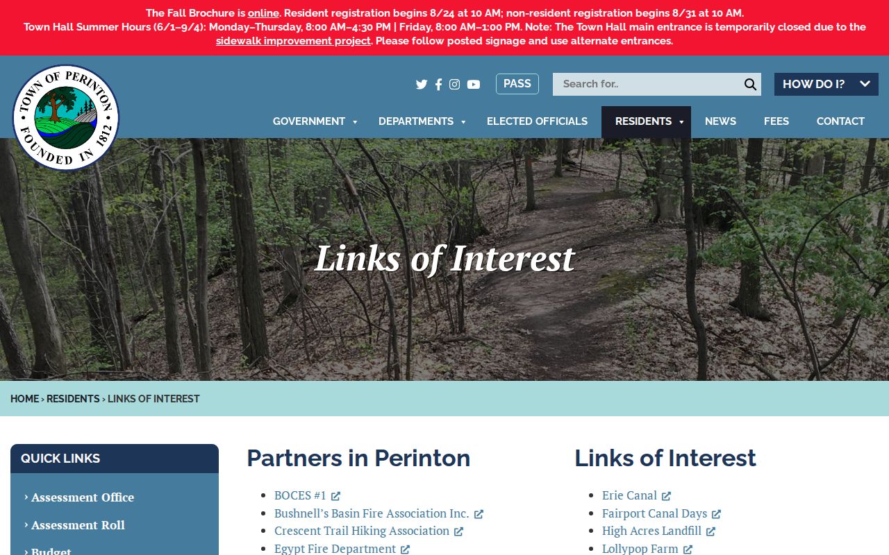
The Town page connects researchers to public organizations. Contact an organization through its own current channel if a public event, archive, or recorded subdivision document is relevant. Do not ask an umbrella directory to supply a private membership or address list.
| Fairport-Perinton Merchants Association | Town-linked business-community lead; no household roster located. |
|---|---|
| Fairport/Perinton Chamber and Fairport Partnership | Public civic and community leads, with organization-controlled contact routes. |
| Crescent Trail Hiking Association | Public recreation association lead, not a neighborhood-membership source. |
| Museum, Historical Society, Lions, Rotary, VFW, Quilt Guild, and fire associations | Public historical, service, cultural, veterans, or fire-service contacts; no public block roster located. |
| Private association or HOA | Verify only through a recorded subdivision document, its own public page, or a direct resident-provided lead. |
Official Records and Neighbor Tools
Official sources give a reader a date, a custodian, and a defined record purpose. Compiled neighbor-search products may combine records from many dates and cannot substitute for a parcel, deed, or official election result. Their categories, accuracy, privacy practices, and lawful-use limits vary. Keep the source label and date instead of copying names into an unverified list.
| Approach | Strength | Limit to preserve |
|---|---|---|
| Official parcel, roll, and deed records | Defined custodian, record date, and legal or assessment purpose | Ownership or title does not prove every occupant |
| Official voter lookup | Person-specific civic result when inputs meet the form rules | No public control to browse every voter on a block |
| Commercial compiled neighbor tools | May surface a lead that needs independent confirmation | Accuracy, privacy, and lawful-use restrictions vary; do not republish lists |
When an official trail is missing, use the record custodian, library, Historical Society, or Town Historian rather than guessing from a name-only result. A Clerk public terminal, a copy request, a reference visit, or a phone and email inquiry are documented alternatives when a web search is incomplete. Note: A map and a tax record reveal different facts and should remain separate in a research log.
Perinton Neighbor Privacy Limits
Public parcel tools do not identify every household member. Utility and delivery records are not public block sources. A voter form requires person-specific fields, and Election Law §5-508 can protect a confidential voter record from public inspection for four years. The New York Address Confidentiality Program can provide eligible participants a substitute mailing address. Do not cross-reference maps, assessment rows, or voting outputs to reconstruct a protected location.
Use the narrowest official source needed. Records may be withheld under FOIL privacy exceptions, and a court, registry, or custody result has its own restrictions. If information is wrong, seek correction from the agency, library, or archive that holds the record. A missing search result is a gap, not permission to make an inference.
Use Perinton Neighbor Records Lawfully
Record the source URL or office, record date, query date, parcel ID where applicable, and the reason a result matches the address. That small log preserves the distinction between property geography, ownership, civic information, and historical context.